Between 2020 and 2050, Africa’s population is expected to double, adding 950 million more people to its urban areas alone. However, according to 2018 figures, a scarcity of affordable housing in many African cities has forced over half of the city dwellers in Sub-Saharan Africa to live in informal settlements. And in rural areas, many also occupy makeshift structures due to widespread poverty.
These shelters have remained largely undetectable using traditional monitoring tools. Machine learning, computer vision and remote sensing have come some way in recognizing buildings and roads, but when it comes to denser neighborhoods, it becomes much harder to distinguish small and makeshift buildings.
Why is this an issue? Because when preparing a humanitarian response, forecasting transportation needs, or planning basic services, being able to accurately map the built environment – which allows us to ascertain population density – is absolutely key.
Enter Google’s Open Buildings
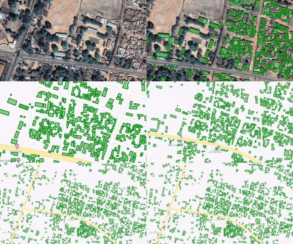
Google’s Open Buildings is a new open access dataset containing the locations and geometry of buildings across most of Africa. From Lagos’ Makoko settlement to Dadaab’s refugee camps, millions of previously invisible buildings have popped up in our dataset. This improved building data helps refine the understanding of where people and communities live, providing actionable information for state and non-state actors looking to provide services from sanitation to education and vaccination.
-
An aerial photograph of a refugee settlement in Uganda
Refugee settlement in Yumbe district, Uganda
-
An aerial photograph of rural dwellings in Ethiopia
Rural dwellings in Sholtaka, Ethiopia
-
An aerial photograph of an urban area in DRC
High density urban area in Kinshasa, DRC
Open Buildings uses AI to provide a digital footprint of buildings. This includes producing polygons with the outlines of at least 500 million buildings across the African continent, the majority of which are less than 20 square meters. The full dataset encompasses 50 countries.
The data provides the exact location and polygon outline of each building, its size, a confidence score for it being detected as a valid building and a Plus Code. There is, however, no information about the type of building, its street address, or any identifying data. We have also excluded sensitive areas such as conflict zones to protect vulnerable populations.
Satellite mapping using AI
The Open Buildings dataset was generated by using a model trained to detect buildings using satellite imagery from the African continent. The information for the buildings detected is then saved in CSV files which are available to download. The technical details of the Open Buildings dataset, including usage and tutorials, are available on the dataset website and the Google AI blog.

How will this improve planning?
There are many important ways in which this data can be used, including — but not limited to — the following:
Population mapping: Building footprints are a key ingredient for estimating population density. This information is vital to planning for services for communities.
Humanitarian response: To plan the response to a flood, drought, or other natural disaster.
Environmental science: Knowledge of settlement density is useful for understanding the human impact on the natural environment.
Addressing systems: In many areas, buildings do not have formal addresses. This can make it difficult for people to access social benefits and economic opportunities. Building footprint data can help with the rollout of digital addressing systems such asPlus Codes.
Vaccination planning: Knowing the density of population and settlements helps to anticipate demand for vaccines and the best locations for facilities. This data is also useful for precision epidemiology, as well as prevention efforts such as mosquito net distribution.
Statistical indicators: Buildings data can be used to help calculate statistical indicators for national planning, such as the numbers of houses in the catchment areas of schools and health centers, mean travel distances to the nearest hospital or demand forecast for transportation systems.
Google’s AI Center in Accra
This project was led by our team at the AI Research Center in Accra, Ghana. The center was launched in 2019 to bring together top machine learning researchers and engineers dedicated to AI research and its applications. The research team has already been improving Google Maps with AI, adding 120 million buildings and 228,000 km of roads across Africa to Maps in the last year. This work is part of our broader AI for Social Good efforts.
